

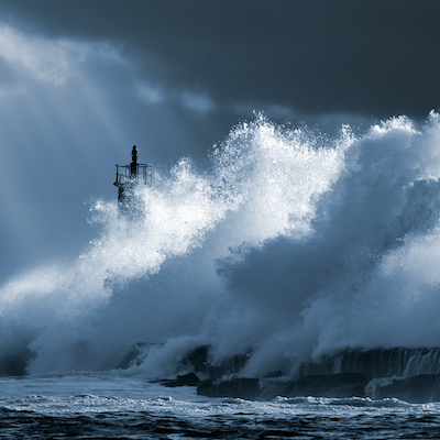
Which of the world’s coastlines will become uninhabitable from wave-driven flooding? Scientists from the University of Auckland have developed an efficient and accessible tool to find out.
Scientists have devised a simple, accessible method to calculate threshold conditions for wave-driven flooding on reef coastlines by comparing modelled flooding levels with two measures of island morphology.
In a paper published by Nature Communication, Dr Eddie Beetham and Professor Paul Kench from the School of Environment in the Faculty of Science reveal their findings on wave, reef and island interactions in face of global sea level rise.
Analysis of 60,000 simulations determined a clear boundary coined ‘the Reef Island Overtopping Threshold’ (RIOT). RIOT is the point at which waves are likely to breach a coral island reef. The RIOT model was tested against known flooding events on a number of different atoll islands.
“Our approach, using RIOT, will enable wide-scale and general assessments of island vulnerability, at present and future sea level, based on easily-measured morphological characteristics.
“The simplicity of our method makes it broadly applicable to calculate threshold wave heights and sea levels associated with overtopping on different islands.
“With this information, island nations will be able to establish timescales for when and where future flooding will occur, providing important baseline knowledge for implementing adaptation measures and identifying areas where site-specific hazard assessments are required,” Dr Beetham explains.
The research also shows that the impact of sea level rise will not be uniform.
“Sea level rise will have a compounding effect for coastal flooding on reef coastlines. The associated increase in reef depth will allow larger waves to reach islands, while the decrease in island height above sea level means that less energy is required for waves to overtop the shoreline.”
“Islands with maximum shoreline elevation less than 1.5 m above spring high tide to be significantly more prone to future overtopping, even if positioned on a shallow and wide reef that effectively dissipates wave energy at present sea level. Frequent wave overtopping is likely to occur on these lower islands with a modest increases in sea level of 0.1–0.4 m.”